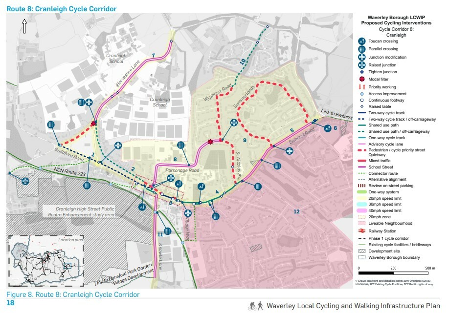
Here are the full details of the proposals as they currently stand
The proposed corridor extends along Cranleigh High Street and links to the NCN Route 223 and existing cycle facilities to Ewhurst. The route serves the retail centre and provides links to local schools.
The proposed corridor overlaps with the on-going Cranleigh High Street Public Realm Enhancement study. To that end, some of the proposals may have to be reviewed in the future.
Proposed Interventions:
1. A new two-way cycle track is proposed along Guildford Road/High Street (B2128 on the north side of the road through the Common). At the side roads priority crossings are suggested for pedestrians and cyclists.
2. A new off-carriageway shared use path is proposed on the north section of the High Street through the Commons along the existing footpath. Widening of the existing footpath is required by reallocating space from the public square.
3. A two-way cycle track is proposed along the retail centre (where Sainsbury’s is) through reallocating space from the carriageway and the footways, which are wide enough. Toucan crossings are proposed to make connections between the proposed facilities and key destinations safe.
4. East of Village Way, the available width along the B2128 does not allow for cycle segregation and a wide shared use path is proposed along the B2128 and Ewhurst Road (B2127). Additional interventions include priority crossings at the side roads and key junctions.
5. Ewhurst Road is narrow with narrow footways east of St Nicolas Ave and therefore advisory cycle lanes are proposed along the carriageway. Additional recommendations include the removal of the centre line and introducing traffic calming measures (Dutch style treatment) to accommodate the proposed cycle facilities.
6. At the eastern end of the village, a toucan crossing is recommended to link the proposed facilities with an existing shared use path on the south side of the road. The shared use path is proposed to be extended to the existing shared use path to Ewhurst.
7. A cycle link is provided along Horseshoe Lane to access Cranleigh School. Dutch style treatment is proposed (current traffic flows 2700 AADT) with advisory cycle lanes and removal of centre lines.
8. A cycle link is provided along Parsonage Road to access the schools and the residential area north of the High Street. A Dutch style treatment is proposed with advisory cycle lanes and the removal of centre lines. A new parallel crossing is proposed to link the new facilities with the existing footpaths and the Glebelands School. A modal filter is recommended at the eastern most end of Parsonage Road to restrict vehicular traffic through movements.
9. The area north of the High Street and Ewhurst Road is proposed as a 20mph zone. Sections of the road network (Summerlands and St Nicolas Ave) are proposed as pedestrian and cycle priority streets. The proposal will be implemented with signs restricting motor vehicle movement to residents, pedestrians and cyclists only.
10. The existing footpath north of Wyphurst Road is to be upgraded to a shared use path.
What have the parents of school age kids in Cranleigh done to deserve this?!
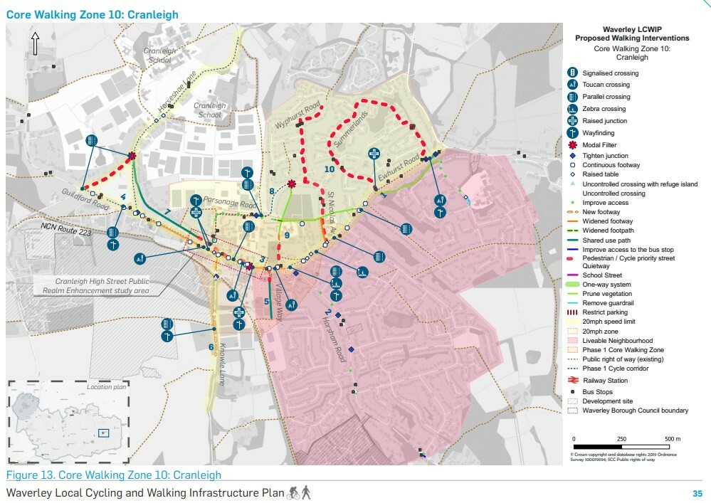
Please see the details on the maps below, the first is the Cycling Path Proposals and the second is the new Core Walking Zone: